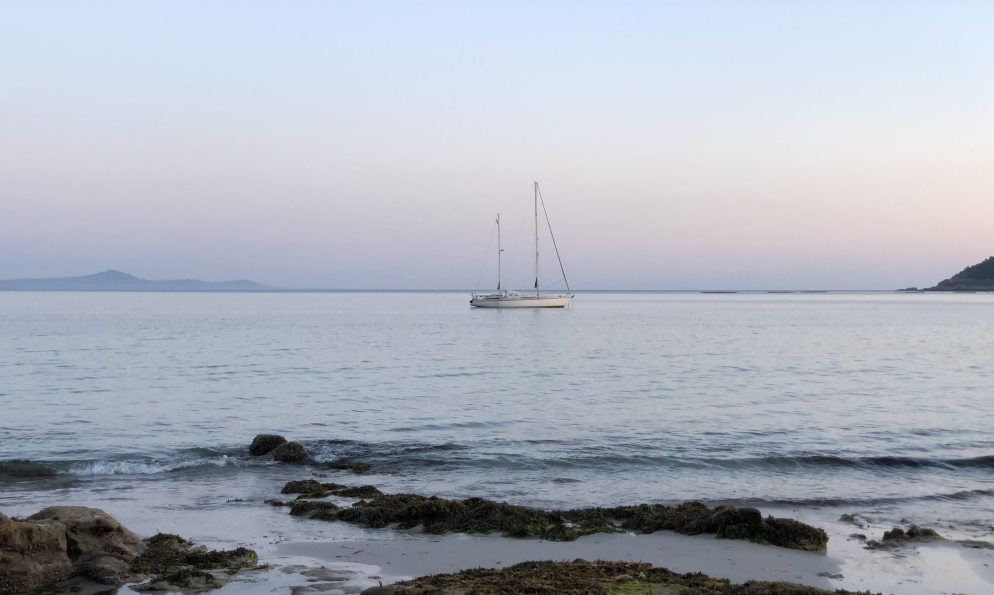


It’s a tough journey, say those we spoke to. We are about to take the leap between Cocos Keeling, Australia’s westernmost island, to Rodrigues, Africa’s easternmost island. A two-week journey of around 2000 nm, right in the middle of the Indian Ocean.
The Indian Ocean looks like a big belly, surrounded by four continents – from Australia in the east, Africa in the west and Asia (Saudi Arabia, India, Indonesia) in the north, all the way down to Antarctica.
One good thing about the Indian Ocean is that there are many small islands to stop at during the long passage. We have already been to Christmas Island , and we have three more to visit before we reach South Africa.
The Indian Ocean is also said to be the windiest sea, in contrast to, for example, the Pacific Ocean, which in Swedish is called the calm sea. Here in the Indian Ocean, this season, constant high-pressure forms that start from Madagascar in the west and go east to Australia. They are the ones that create both the trade winds we love to sail on and long-distance swells – waves that we already knew when we started would be 4–5 meters high.
Decision on Departure
We are already in the best season to sail in these waters, as the prevailing winds are from the east-southeast, giving us wind and waves from behind – a must for sailing, on any sea.
Still, there are differences – it’s windy – more or less. Here at Cocos Keeling, we had a gale last week. No one moved, and the cargo boat that came did not unload because of high waves and swells.
What follows are my daily notes and photos from this journey.
How was it to sail on the Indian Ocean in the high waves and strong wind?
Day 1, Monday 21 August

We set off early in the morning when it was still high tide, the first calm day after the gale. So do even Rondo and Alado, the other two yachts that arrived around the same time as us. The anchor is filled with coral sand, which easily slides off. We announce our departure to the Cocos police, and on the way out we notice that the cargo ship had begun to unload. We see flocks of birds flying close above the water – a sure sign of fish below.

Just after an hour, we set a direct course towards Rodrigues. The wind increases, so we take an early reef in the Genoa and before night falls we take a second reef when the wind increases to 25 knots. Over 20 knots are a lot of wind, and safety is always paramount. We rest as much as we can, and we call our mothers when it’s still calm.
After the sun sets, we encounter two cargo ships, both on a collision course. After some talk on the VHF, they adjusted their course. We have no idea if there will be many boats on this trade, or not. Regardless, every meeting requires careful monitoring, especially at night.
An early warning
An important rule is to always keep our hand on something because we never know when a big wave might cause an overhaul. Cooking is therefore a challenge and a balancing act. We got an early warning today when captain fell to the floor when a big wave suddenly rocked the boat. Luckily, he managed with just bruises and a sore back and elbow. We take out the safety harness for the stove for the first time.
Day 2, Tuesday 22 August

We sail towards the sunset in the west, so the sunrise is always in the stern. On the second day we only see the sun in the morning and in the evening, in between it is a grey day. It feels calmer, we are getting used to 20 knots. The wind continues to increase. We make good speed, 174 nm (nautical miles), on the first day.
We look ahead at the weather forecast and see more wind and high waves for the coming weekend. What is it like to sail in five-meter waves? I’ve never done that before. Is it dangerous? How can we prepare? We cook some food in our pressure cooker and set up the back cover in the cockpit.

Day 3, Wednesday 23 August

The wind is now down to 13 knots, we did 160 nm on the last day. We have already completed 25% of the journey – something to celebrate! There aren’t many boats out here – just two cargo ships on long distances.

Day 4, Thursday 24 August
We measure how far we have sailed each morning to estimate the arrival time – on the last day we did 165 nm, and the wind was around 15 knots. It’s a grey day, and we know this will be our last slow day. We bake bread and a yummy lamb stew. In the evening the wind starts to turn – for seven hours there is no wind at all, so we drive through until the wind increases rapidly at midnight, and soon we take in two reefs again. On the weather maps, we can see that we are on the edge of a high-pressure area.

Day 5, Friday 25 August
We are now in the area of relentless and unstoppable trade winds. It goes fast – we make eight knots, even though we have four reefs taken. We lie on the sofas. What’s a bit strange is that I decided to start writing my story with flowers. It’s a perfect distraction, and it makes me happy to go through all my photos with flowers and write about my love for them.
Day 6, Saturday, 26 August – Halfway!

It still goes fast, the gusts are up to 30, so we keep the four reefs. The day’s distance reaches its peak at 183 nm. We’re halfway there! It is a mentally important milestone. It is not closer to turning around if something happens. You just know you have to keep going. You also know that the boat can handle open seas and wind.
This day we realized something else, namely that our gas probably won’t last the whole trip. We have two bottles in a cupboard in the stern stowed away, so we just need to change the fittings, usually very easy. On the open sea with waves washing over, even that is too risky. Balancing at the back of the deck, and picking up a few things to reach the locker, is just something we don’t want to do. We don’t go outside the cockpit at all. So, this was a lesson learned. In the meantime, we’re keeping our fingers crossed that it lasts, and we’re discussing our options for various canned and cold food.
Day 7, Sunday, 27 August
The waves get higher and higher, coming from behind and rapidly rolling forward one by one. I force myself to go out and look at them, I know it helps. I see and feel that we are being carried. Very fascinating and astonishing.
Day 8, Monday, 28 August

Today we reach the peak – the waves are 4–5 meters high, and we are still being carried! The difference isn’t that big, we’ve slowly gotten used to the higher levels. The weather is dramatic, with clouds shifting rapidly and suddenly picking up the wind and pouring down rain. The captain feels the contradictory movements in the boat – there is the wind and waves coming from behind (east), but also swell, bigger waves coming from far south.

Day 9, Tuesday 29 August

Finally, it turns – the wind drops, and we take out two reefs and now have ”only” two reefs furled. A nice sign is a bird and a flat rainbow, something I’ve never seen before.

Day 10, Wednesday, 30 August
It’s a great feeling to sail towards the moon. This is early in the morning when it’s on its way down.

Today it is even nicer, the wind blows 15 knots and fills our now-released Genoa perfectly. I take care of sunbathing, which rarely happens. And to my delight, a double rainbow lights up in the afternoon. Captain and I have a good sharing, or perhaps more accurately debriefing time, with each other.


The moon goes up before the sun goes down!

Day 11, Thursday, 31 August

We get a beautiful sunrise and later a dramatic sunset. It’s a full moon tonight, so I am not surprised.


Captain treats us with homemade pan bread made from tapioca flour. Luckily for us, the gas lasted until this day, and we had no problem at all changing to a new bottle.
We are going slower now, the wind is down to 13 knots which means that the feeling of swell increases, as the wind does not match the still quite high waves.
Every rainbow is worth a picture as it is pure magic.

We are getting closer to Rodrigues, with only 130 nm to go. In the evening, we start to see other boats on the plotter. At first, it looks like one fishing boat, but the closer we get there are more and more of them, a whole little armada.

Day 12, Friday 1 September

We are happy to arrive in daylight. As usual, we see land from afar. It takes hours and hours to get closer. We thought we should get some lee from the island, but instead, the wind increases the closer we get.

We shall pass through an invisible reef; we just have to trust the plotter. Captain searches for a transit line without success. After a long while, I see a bright white light on a house in the direction we are moving. It must be for us seafarers. We proceed slowly and when we are inside the reef we take down our Genoa pole before turning 90° to the anchorage. There is a large cargo ship at the dock and a single sailboat. We anchor next to him, and soon we have two people from the border police and one from the health administration on board. You should have seen the eyes of the police officer in charge – so loving. Imagine all the police officers in such strong contact with their hearts!
After the quick meeting, we had to take the dinghy ashore to face customs and immigration, fill out many more papers and show passports. Before we were ready with everything, the sun was almost gone. Tired and satisfied, we celebrated this journey, 2013 nautical miles in 12 days and six hours, as successfully completed.

Saturday, 2 September, in Mathurin, Rodrigues

We are very happy that we managed to arrive in time for the Saturday market. Once a week the local farmers turn up at the marketplace and as we haven’t had a market since Darwin six weeks ago, we were eager to see what they could offer us. We were pleasantly surprised, everything looked very fresh, and the range was wide. We secured eggs and fresh vegetables and went back to the boat to wash, clean and rest.

LESSONS LEARNED
- We manage more than we think.
- It helps to be present, breathing into what is.
- Worrying about the unknown (high waves in this case) is 100% unnecessary and helps nothing.
- It’s wonderful to have a boat that is seaworthy, rainproof and can take the waves smoothly.
- Tasty food is a nice treat, preferably pre-cooked.
- There is no need to be seasick – preventive pills exist and they work.
- Take it easy and relax a lot.
- Unexpected creativity can come even under those circumstances.
- The ocean carries us, again!
NEXT STEP
Our next passage will be from Reunion to Richards Bay, around ten days. Stay tuned.


